

PUKANEC ORE MINING EDUCATIONAL TRAIL
First written note about village of Pukanec originates from foundation charter of abbotship in Hronský Beňadik (1075) where it has been mentioned as Villa Baka. Pukanec and its environs were once a booming gold and silver mining and processing site. In 1345 King Charles Robert (Charles I of Hungary) awarded this mining village with rights of free mining and royal town in 1345. Later, in 1876 when mining operations ended Pukanec became a municipality affiliated to the Hont district (Hontianska stolica).
Theme trail tour starts on main square of Pukanec in front of the Lutheran church where also a board with a map of the trail is erected. Trail follows Viničná cesta street heading to the south-west and then turns to the north-west into the Chorvátová dolina valley. Trail is marked by green signs and has 12 stops. Each stop is provided by an informative board, next to the mine pit Dorothea (9th stop) is an open shelter.
Reserve 2-2.5 hrs to complete the 5 km long tour. For guided tours call Terra Banensium at contact
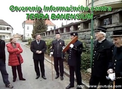
Pukanec Ore Mining Educational Trail project, realization and maintenance by NGO Terra Banensium - Land of Miners
Theme trail tour starts on main square of Pukanec in front of the Lutheran church where also a board with a map of the trail is erected. Trail follows Viničná cesta street heading to the south-west and then turns to the north-west into the Chorvátová dolina valley. Trail is marked by green signs and has 12 stops. Each stop is provided by an informative board, next to the mine pit Dorothea (9th stop) is an open shelter.
Reserve 2-2.5 hrs to complete the 5 km long tour. For guided tours call Terra Banensium at contact
Pukanec Ore Mining Educational Trail project, realization and maintenance by NGO Terra Banensium - Land of Miners
1st stop: coopers yard (361 m a. s. l.)
Cooperage that is related to wine-making has a long tradition in Pukanec. Ladislav /Darvas/ Hruskovic is the last craftsman who inherited this trade from his father.
A cooperage museum is planed o be opened in the yard.
Cooperage that is related to wine-making has a long tradition in Pukanec. Ladislav /Darvas/ Hruskovic is the last craftsman who inherited this trade from his father.
A cooperage museum is planed o be opened in the yard.
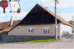
2nd stop: well of Barca (368 m a. s. l.)
About 20 m left between gardens is a
curiosity - a well with bubbling water.
About 20 m left between gardens is a
curiosity - a well with bubbling water.
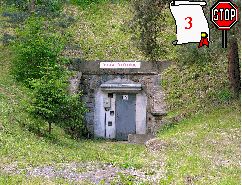
3rd stop: mine shaft Ergi (381 m a. s. l.)
Beginnings of mining in this pit date back to the first notice on Villa Baka (1075). Later water flowing out has driven ore processing machinery. Today it serves as water-supply of the village. Passing the building called /Betón/ the path enters the Chorvátová dolina valley.
Beginnings of mining in this pit date back to the first notice on Villa Baka (1075). Later water flowing out has driven ore processing machinery. Today it serves as water-supply of the village. Passing the building called /Betón/ the path enters the Chorvátová dolina valley.
4th stop: mine pit Maria (400 m a. s. l.)
Similarly, as mine pit Ergi drains hill Vajrab, the pit Maria drains nearby hill Pukliar.
Similarly, as mine pit Ergi drains hill Vajrab, the pit Maria drains nearby hill Pukliar.
5th stop: mine shaft Jacob (402 m a. s. l.)
Remnants of the mine are situated on the left slope of the Chorvátová dolina valley. Gallery lead up the south where it was connected with mine pit Ergi. Last reference about the pit date from 1755.
Remnants of the mine are situated on the left slope of the Chorvátová dolina valley. Gallery lead up the south where it was connected with mine pit Ergi. Last reference about the pit date from 1755.
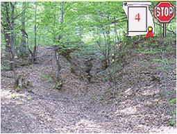
6th stop: mine shaft Theresa (410 m a. s. l.)
This earthed up pit is situated also on the left slope of the valley. In front of pit is a mullock tip.
This earthed up pit is situated also on the left slope of the valley. In front of pit is a mullock tip.
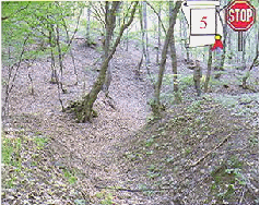
7th stop: mine shaft Joseph (460 m a. s. l.)
Following marking of the path remnants of the pit Joseph can be seen on left side of the valley.
Following marking of the path remnants of the pit Joseph can be seen on left side of the valley.
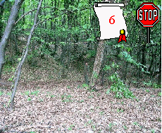
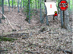
8th stop: mine shaft Weitenzeche (480 m a. s. l.)
According to local chronicle the pit was buried as early as in 1630. Last written statement on the pit dates in 1654.
According to local chronicle the pit was buried as early as in 1630. Last written statement on the pit dates in 1654.
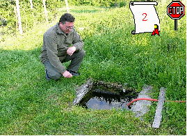
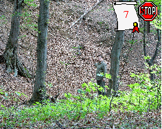
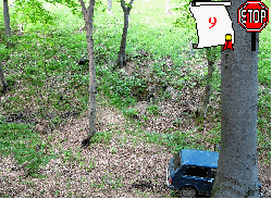
9th stop: mine shaft Dorothea (495 m a. s. l.)
Dorothea is the only accessible mine tunnel on the trail. The portal of the shaft is on the bottom of right slope and the gallery is about 150 m long (up to a cave in). According to Frantisek Platzer (1878) metal content of gold and silver was up to 30 g/t.
Dorothea is the only accessible mine tunnel on the trail. The portal of the shaft is on the bottom of right slope and the gallery is about 150 m long (up to a cave in). According to Frantisek Platzer (1878) metal content of gold and silver was up to 30 g/t.
10th stop: mine shaft /Square/ (490 m a. s. l.)
Remnants of a mine shaft are called /Square/ according to the shape of its opening (original name not available). Weitenzeche ore vein runs there.
Remnants of a mine shaft are called /Square/ according to the shape of its opening (original name not available). Weitenzeche ore vein runs there.
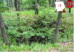
11th stop: mine shaft Funel (501 m a. s. l.)
Opening of a funnel-shaped shaft is 10-12 m deep (original name not available). It follows also ore vein Weitenzeche.
Opening of a funnel-shaped shaft is 10-12 m deep (original name not available). It follows also ore vein Weitenzeche.
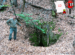
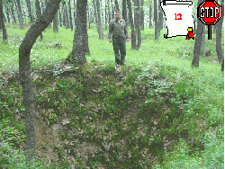
12th stop: mine shaft /Kozacka/ (490 m a. s. l.)
Ore vein Petri runs in this shaft and ore vein Joseph ends also somewhere there.
Ore vein Petri runs in this shaft and ore vein Joseph ends also somewhere there.
ADRESÁR BANÍCKYCH SPOLKOV A CECHOV SLOVENSKA


Združenia baníckych spolkov a cechov Slovenska

Občianske združenie
je členom
je členom
